")
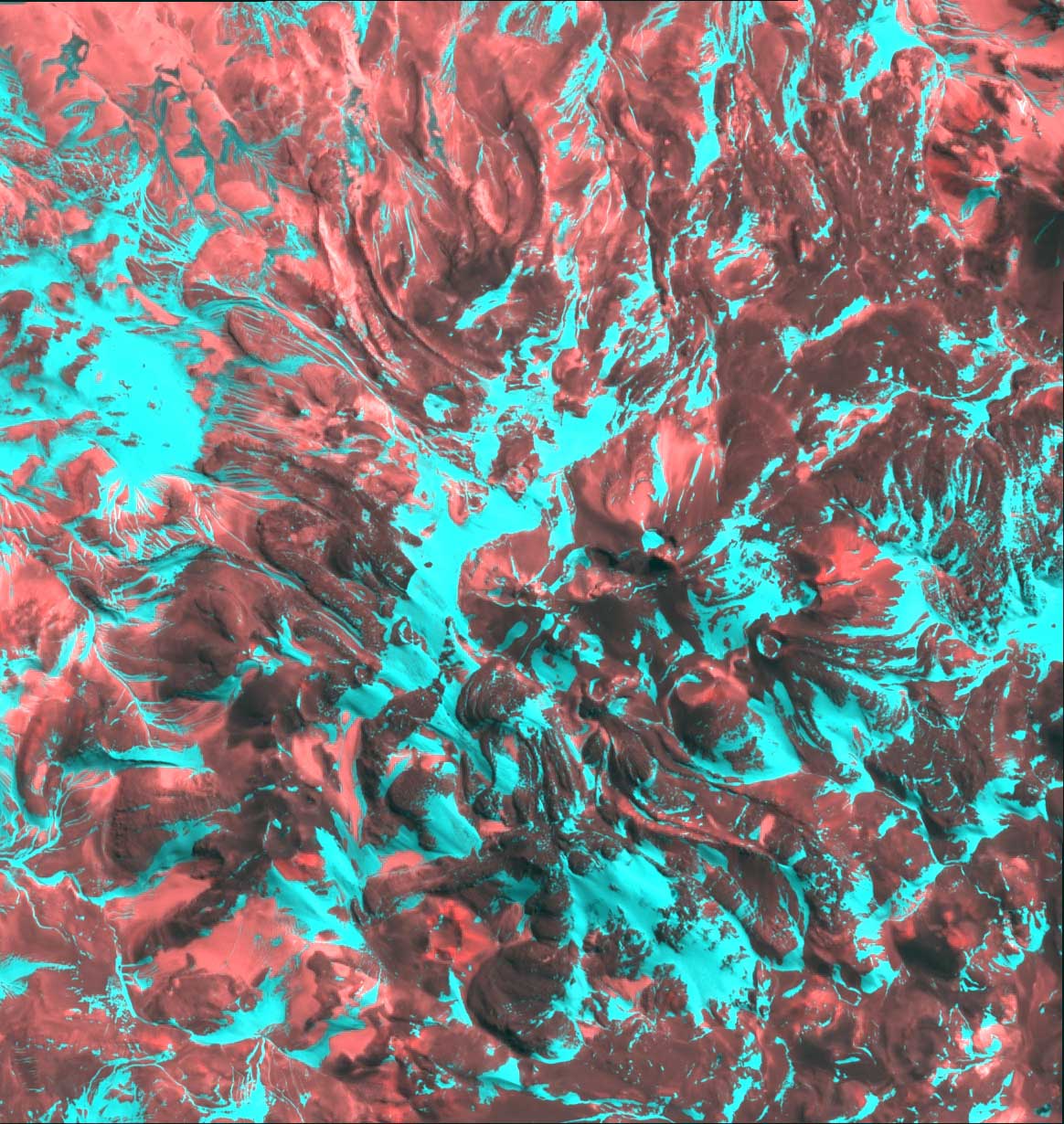
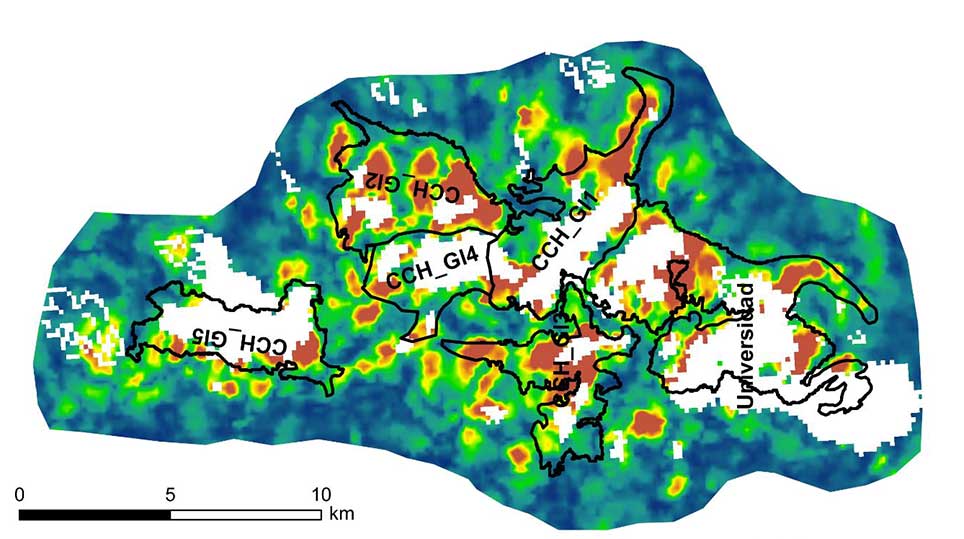
- remote sensing and GIS-based long-term glacier-velocity analyses – investigation of the effects of glacier-ice thinning and glaciohydrological changes
- analyses of spatial distribution of surface ice – as an important factor of the water resources in the dry mountains
- remote sensing, GIS and field based separation of snow, firn, perennial ice and glacier surfaces in the dry/arid Andes – the use of Feature- and Speckle Tracking methods from the arid to humid temperate Andean glaciers